

By JOHN PEPIN
Michigan Department of Natural Resources
In 1896, northeast of Calumet on the rugged Keweenaw Peninsula, lumberman Ernest Koch was cutting a wood road through the trees and brush when, like television’s Jed Clampett, he accidentally stumbled onto a valuable find.
Koch discovered an important native copper ore body in defiance of conventional thought that suggested the location was situated too far to the east to be connected to the Kearsarge lode – an ore body that produced 14.5 million pounds of refined copper from 1887-1897.
Two years after Koch’s discovery, Joseph E. Gay and other founders established the Mohawk Mining Co. there, which would become one of the richest properties in the Michigan copper district.
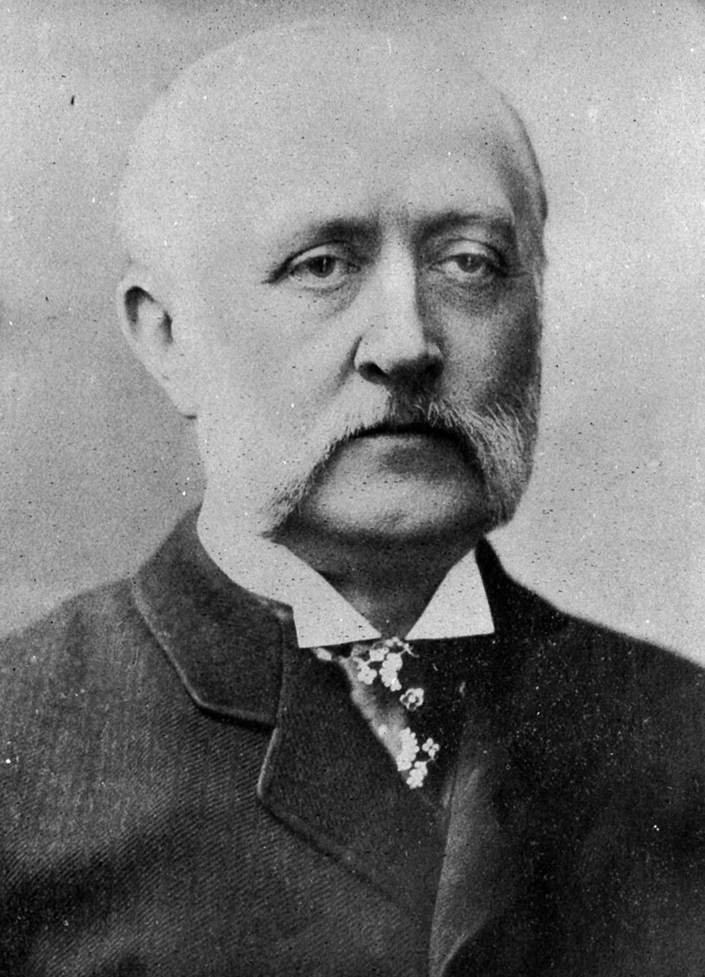
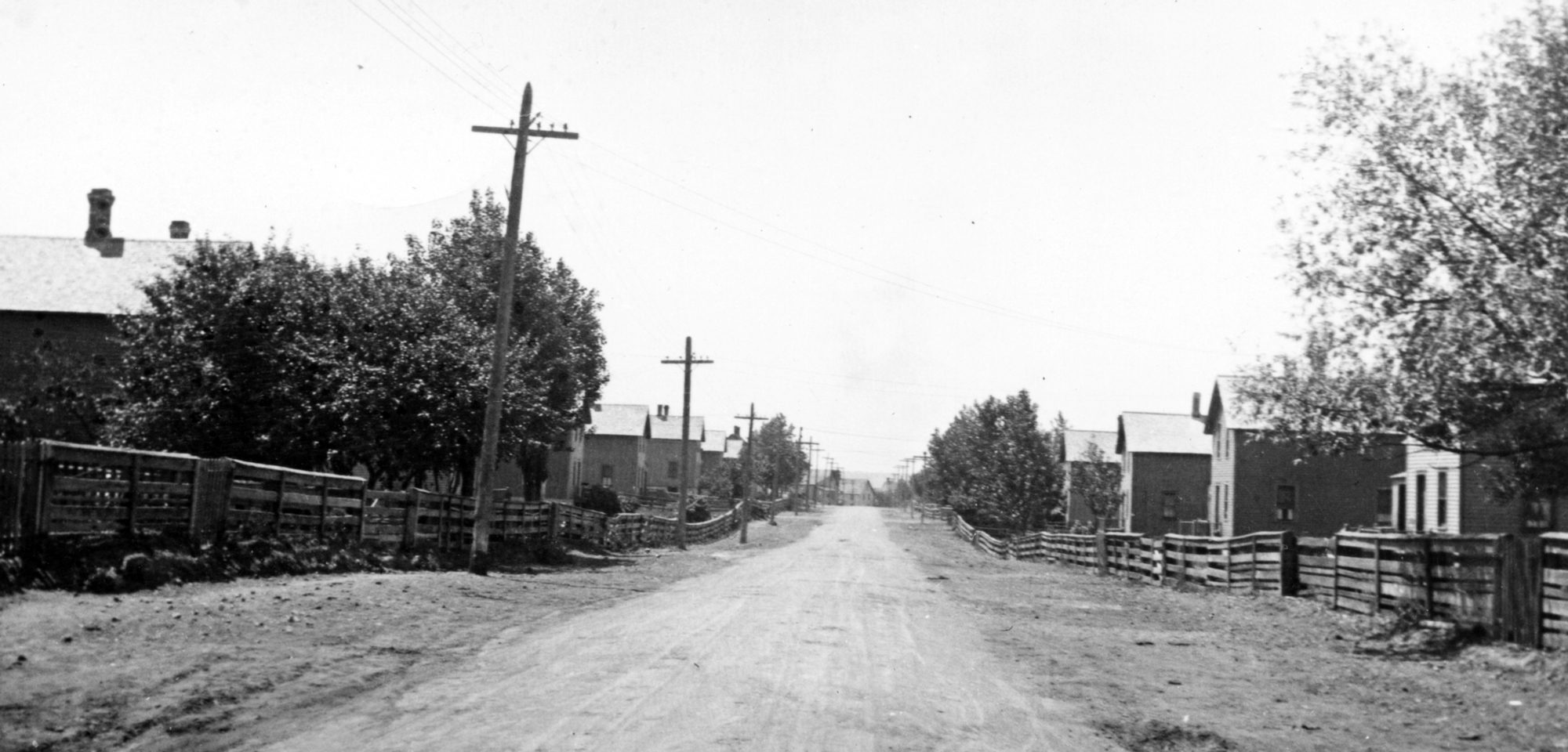
The village of Mohawk would spring up around the mine, with the mining company building and overseeing numerous attractive two-story homes. The mining company’s first president was John Stanton.
In 1900, mining at the Mohawk would uncover a large amount of a new, valuable, endemic mineral – a previously unknown combination of algodonite, domeykite and copper, which was named Mohawkite.
“It is reported that there is now in sight at the Mohawk mine mohawkite which would net the company something over $400,000,” the Detroit Free Press reported in April 1901.
The mining company acquired a dock at Lake Superior and a railroad that formerly served a local Jacobsville sandstone quarry. To process the copper ore into concentrate, the mining company needed a stamp mill located near Lake Superior, where an ample supply of water was available.
“President Stanton has recently stated that he expected the mohawkite to pay all the expense of developing the Mohawk mine beyond the small assessment which will be called for equipping the mill and railroad,” the Detroit Free Press reported.
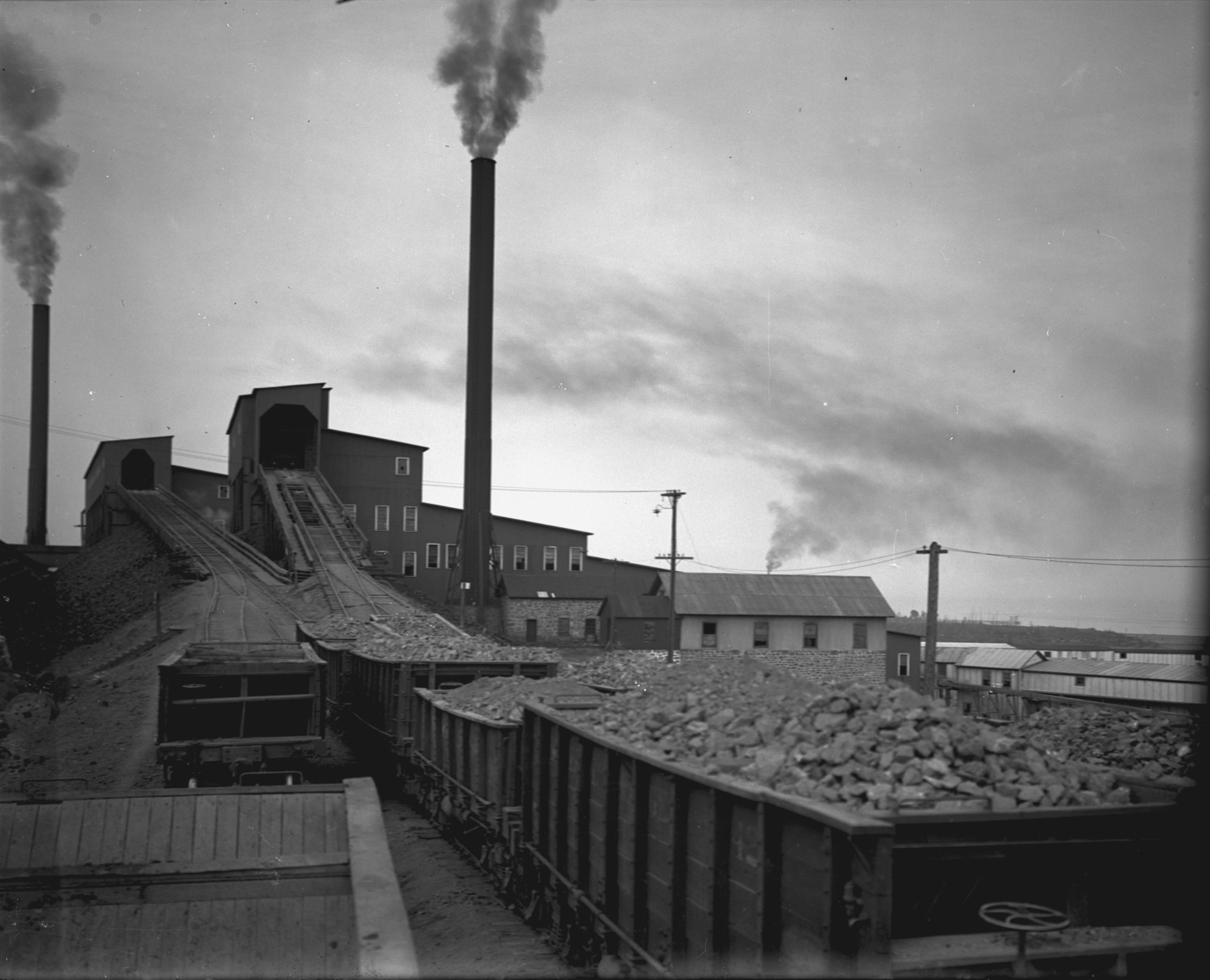
In 1900, the mining company built a four-stamp mill, located 13 miles from the mine, where ore was crushed by the stamps and the copper separated through a water flotation process. The mill included a smokestack that towered 265 feet above the ground.
As in Mohawk with its mine, a community developed around the stamp mill, which was named for Joseph E. Gay, Stanton’s successor as Mohawk Mining Co. president. The area around the developing stamp mill had formerly been involved in fishing and lumbering.
Two heads of stamps were ready to operate in October 1902. The first shipment of rock from the Mohawk Mine was made in November that year. The two stamps were in operation by mid-December. The third stamp head began crushing rock in March 1904.
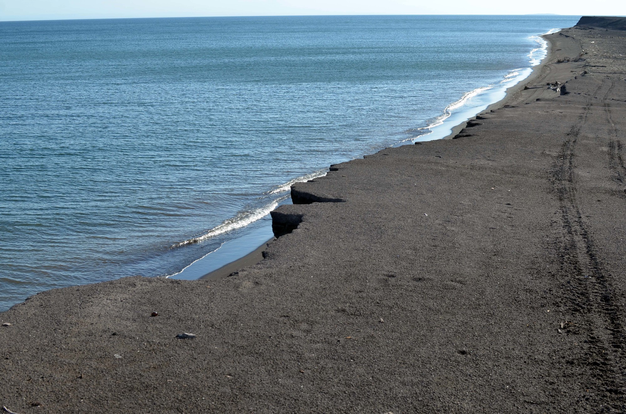
Coarse, black stamp sands were created as a by-product of the milling work, which were dumped into Lake Superior and on the shore at the stamp mill site.
Likely unforeseen during this period of copper mining development, the stamp sands would later cause significant problems for valuable natural and economic resources in the Copper Country.
Find out more about the effort to save Buffalo Reef
In 1923, the Mohawk Mining Co. absorbed the Wolverine Mine – an operation that opened in 1882, closed in 1884, reopened in 1890 and closed permanently in 1925.
“When the Wolverine mine suspended operations recently after 35 years of almost constant activity, there passed into history one of the most successful openings ever drilled in the Michigan copper region,” the Times Herald of Port Huron reported in May 1925. “Exhaustion of mineral resources in four shafts, all of which had reached a depth of nearly 4,000 feet, caused abandonment of the mine.
“…During its banner years, the mine recovered as high as 26.82 pounds from each ton of rock. An original investment of $300,000 in the property brought total dividends of $10.3 million before the reserves began to show signs of diminishing. Production at one time reached a maximum of 10 million pounds of refined copper a year.”
The ore from the Wolverine Mine was originally processed through a small stamp mill at the mine, but in the 1890s, after the mill reopened under Stanton’s supervision, a new stamp mill was built next to the one operated by the Mohawk Mine and opened in 1902.
“This new structure was a smaller cousin of the Mohawk’s Mill – which was being built next door around the same time,” the Copper Country Explorer website stated. “True to the close partnership between the two John Stanton-operated mines, the mills shared a pumphouse and a superintendent, were built simultaneously, and closed within years of each other. The Wolverine would shut down 7 years before the Mohawk, in 1925.”
In its heyday, no company in the Michigan copper district produced as cheaply as the Mohawk Mine.
“In 1931, costs were 7 cents a pound,” the Bessemer Herald reported. “In 1932, due to richness of ground, freedom from further development expense and lower wages, costs were finally reduced to less than 4.5 cents a pound.”
However, a year later, the outlook for copper mining was discouraging given open-pit competitors in western states and other countries, and a diminishing supply of copper in the Mohawk Mine.
“Engineers estimated the life of the mine to be two years from Jan. 1, 1932 at the then maximum production rate, followed by one or two years of declining production,” the Bessemer Herald reported said in February 1933. “Last fall, however, serious ground subsidence in the only working unit, No. 6 shaft, hastened the decision to permanently suspend operations.”
Over its lifetime, the Mohawk Mining Co. paid more than $14 million to stockholders, and many millions more in wages, supplies and equipment, according to the Bessemer Herald.

At its height, the mine employed roughly 1,000 workers.
“When operations ceased last fall, Mohawk had in storage at the stamp mills at Gay concentrations equivalent to more than 30 million pounds of refined copper,” the Bessemer Herald reported. “This mineral is being shipped to Houghton and converted into metal at the Michigan smelter, in which Mohawk has an interest. Sales of this copper have been made throughout the winter.”
In October 1933, the stamp mill was being scrapped by dealers who bought the building and machinery. By this time, the stamp sands piled in and at Lake Superior extended the shoreline of Sherman Township a mile into the lake.
The Copper Range Co. acquired the Mohawk Mine property and stamp mill site in 1934.
“Mine machinery was sold and moved away. Modern mine dwellings, the boast of the industry for years, were sold to their miner tenants for a meagerly $1 a room, another expression of ‘severance of employment’ relief to minimize the disturbance of lost employment and facilitate efforts to eke out an existence farming the rocky but fertile hardwood lands,” the Detroit Free Press reported in July 1936.
Some remnants of the Mohawk Mine remain today, including the Keweenaw County Road Commission building at the south end of 4th Street, which was once the mine’s machine and blacksmith shop. An avenue in the village is named for John Stanton.
Limited ruins of the Wolverine Mine also remain.
By the end of the copper mining boom, the operation of various mines in the region deposited a total of roughly half a billion tons of stamp sands throughout the Keweenaw Peninsula.
As the years passed, the action of Lake Superior’s breaking waves, longshore current, winds and storms have drifted the stamp sands at Gay southward, covering native white sand beaches.
Estimates from 1938 to 1999 suggested the stamp sands there were receding at an average of 26 feet per year.
The pile of stamp sands at Gay was originally estimated to contain 22 million cubic yards of material, with 2.3 million cubic yards of material remaining today. The drifted and deposited stamp sands are estimated to cover 1,426 acres of shoreline and lake bottom.
Today, ruins of the stamp mills complex can be found at the base of the smokestack, which continues to stand high above the trees and the tiny community of Gay, which has a population of roughly 60 residents.
With the dark stamp sands covering the shore, the barren beach at Gay resembles the blank surface of another planet. Parts of the large wooden dock remain at the water’s edge.
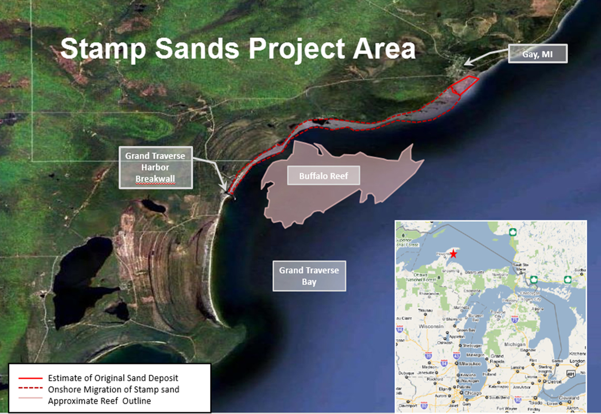
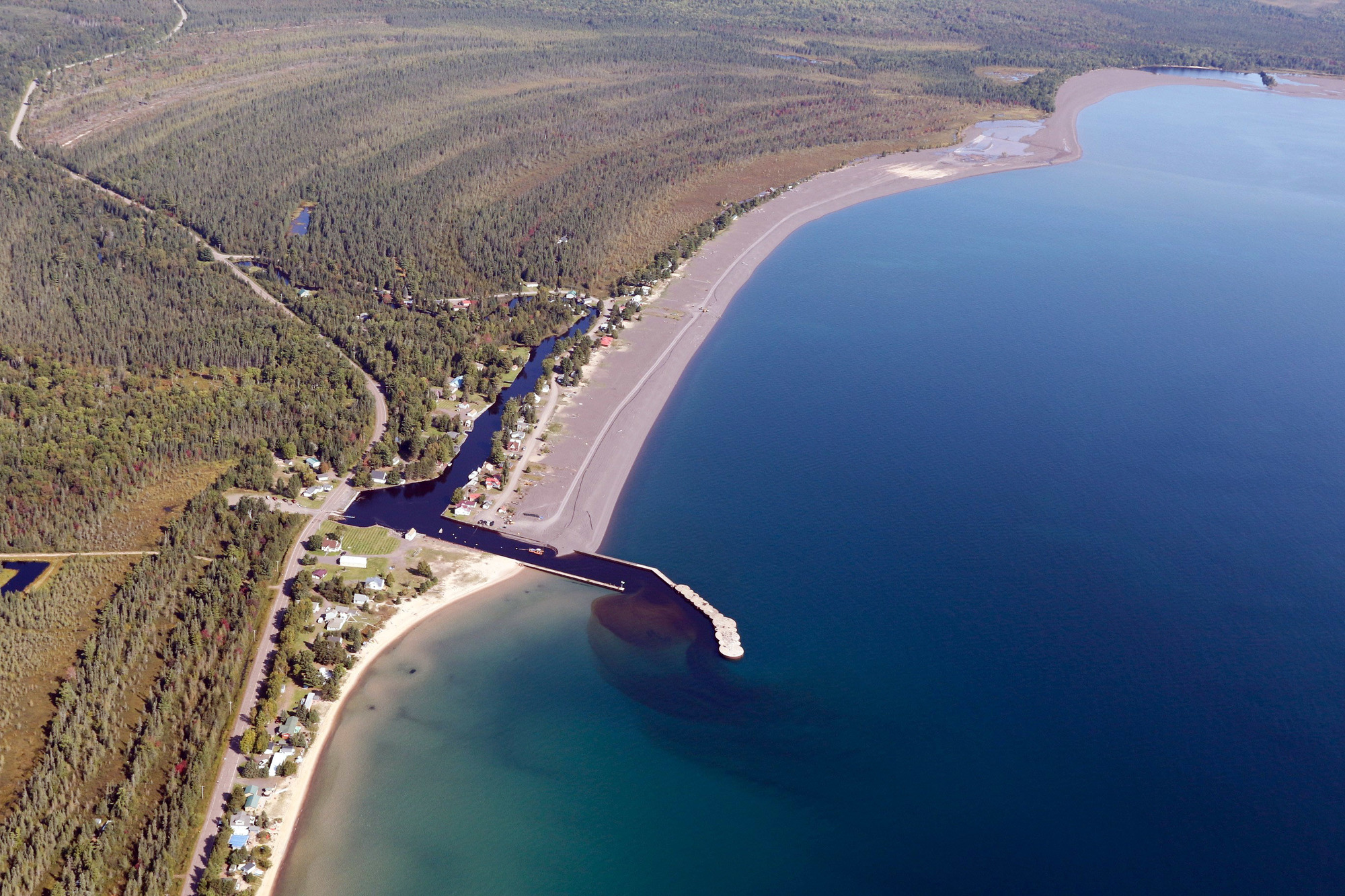
About five miles south, the Traverse River dumps into Lake Superior at Grand Traverse Bay Harbor, which was built from 1949-1950 by the Thornton Construction Co. of Hancock.
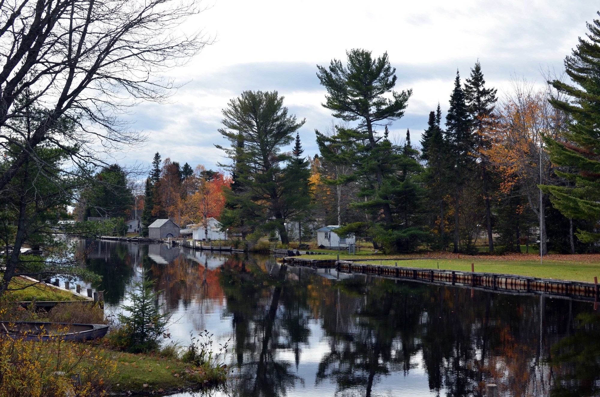
Before reaching its mouth, at the commercial and recreational boating harbor, the river moves slowly, lined by homes and cottages, docks and yards.
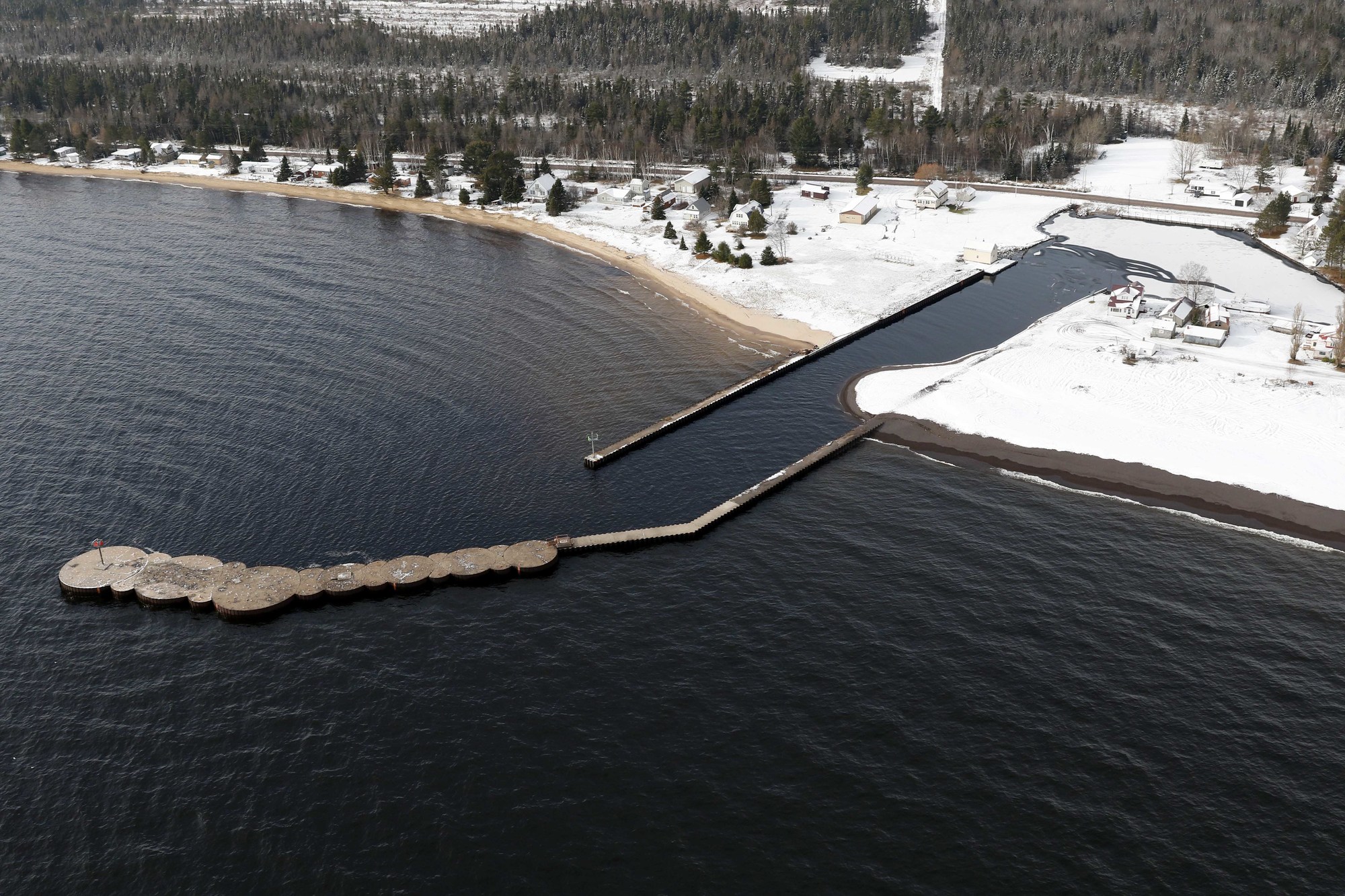
The harbor acts as a barrier, a dividing line, between the stamp sands migration and the natural beaches to the south and the important lake trout and whitefish habitat of Buffalo Reef.
In 2009, the stamp sands first reached the harbor. After several subsequent dredging efforts, most recently this past fall, a late October storm pushed the black stamp sands over a retaining wall and into the harbor.
Offshore lies Buffalo Reef, a 2,200-acre spawning reef critically important to lake trout and lake whitefish, and the people who benefit from those fish populations.
Like the harbor, the reef is threatened by the continued movement of the stamp sands.
“It is currently estimated that this reef, critical to both lake trout and lake whitefish populations in the area, is currently 35 percent unusable by spawning fish due to sand that has filled spaces between rocks, which are necessary for successful fish egg deposit and incubation,” said Phil Schneeberger, Michigan Department of Natural Resources Lake Superior Basin coordinator. “Furthermore, migrating sands along the shore have made nursery areas useless to newly hatched fish.”
Both lake trout and whitefish spawn on the reef. The trout move to deep water for juvenile recruitment while the whitefish move close to shore, especially south of the harbor.
Nearly a quarter of the annual lake trout yield from Lake Superior’s Michigan waters comes from within 50 miles of Buffalo Reef. The Great Lakes Indian Fish and Wildlife Commission estimates the annual economic benefit of the reef at $1.7 million.
“The Keweenaw Bay Indian Community, as well as other tribes located around Lake Superior, are and have always been fishing tribes,” said KBIC President Chris Swartz. “Since time immemorial, these tribes have used the resources provided by gitchi-gami (or Lake Superior) to sustain their communities. This sustenance is not only physical; it is also spiritual, cultural, medicinal and economic.”
Swartz said modeling predicts that by 2025, 60 percent of the reef no longer will be viable for lake trout and whitefish spawning.
In testimony before Congress, Swartz said burying of the reef fish habitat in stamp sands would likely result in the loss of about 125,000 pounds of whitefish and 12,500 pounds of lake trout annually.
“If the reef is lost, over $1 million in tribal fishing jobs would also be lost,” Swartz said. “There would be additional impacts to the recreational fishery, as well as to local businesses that rely on locally caught fish.
“Buffalo Reef is also important as a source of genetic diversity to Lake Superior. Fish tagged on the reef have been caught as far away as Pancake Bay, Ontario and the western arm of Lake Superior.”
According to Charles Kerfoot, a biological sciences professor at Michigan Technological University in Houghton, an estimated 4.6 million cubic yards of stamp sand has been deposited on the beach south of the original pile.
Another 6.6 million cubic yards have moved into Grand Traverse Bay, with 2.9 million cubic yards drifted into a trough that lies just north of the reef. The Keweenaw County Road Commission uses about 900,000 cubic yards of stamp sands for road treatments.
Several agencies, including the DNR, Michigan Department of Environmental Quality, U.S. Army Corps of Engineers, Keweenaw Bay Indian Community and U.S. Environmental Protection Agency are working to develop a long-term management plan for protecting the reef.
Meanwhile, the EPA has provided $3.1 million to the Army Corps to design and carry out more dredging, expected to take place next spring.
“This dredging project would buy 5 to 7 years of protection for the reef and the whitefish juvenile recruitment area south of the harbor,” said Steve Casey, Upper Peninsula district supervisor for the DEQ’s Water Resources Division. “In the meantime, we need to develop a long-term, adaptive management plan, a solution, for the Gay stamp sands problem.”
Standing on the beach at the Grand Traverse Harbor, looking north you see the black stamp sand beach, dotted with wooden benches and makeshift picnic tables, and in the distance, the Mohawk stamp mill smokestack.
Looking south you see the natural sand beaches.
After more than a century, it’s staggering to consider the rich copper mining history of the Mohawk and Wolverine mines, and the tremendous wealth, commerce and industry derived that provided jobs and a livelihood for miners and their families.
It’s also hard to grasp that the stamp sands piled on the beach and into the lake all those years ago have caused such serious problems today, threatening vital fish populations, recreational opportunity and the economic fortunes of many.
Looking to the future, we envision the ongoing hard work of countless people, providing hope the reef will be saved and restored for fish and people alike, for generations to come.
Check out previous Showcasing the DNR stories and subscribe to upcoming articles at www.michigan.gov/dnrstories.